Expert says we could see "fantastic growing season" this year

Eric Snodgrass, principal atmospheric scientist for Nutrien Ag Solutions, says Wisconsin and the rest of the Midwest could see extremely favorable growing conditions later this spring and summer if current models are correct.
Current weather models are predicting some higher temperatures to hit Wisconsin in May and June, but a jet stream from the northwest may pull in by July and cool things down before it gets too hot and dry in the fields. Snodgrass said that historically, hot and dry growing seasons correlate with poorer yields of corn and soybeans, while cool and wet seasons bring in higher yields.
"The (jet stream) cascades out of the northwest through the Great Lakes Basin, and if the models get this right, we are set up for a fantastic growing season," Snodgrass said. "By mid-June, that's when we'll have an idea about this. It just takes a long time to get there."
Snodgrass said that the Pacific Meridional Mode, essentially a measure of Pacific Ocean surface temperatures that impact weather patterns like hurricanes, is looking to be on the positive side, which means cooler and wetter weather coming from the West Coast due to colder surface temperatures in the ocean. A negative PMM typically leads to hotter and drier conditions.

While drought is a concern for 60% of the US, it's not a concern in Wisconsin. Areas in the southwest, like California and Texas, as well as North and South Dakota are experiencing some of their driest seasons on record this year, Snodgrass said. North Dakota is experiencing its driest year on record – and they're currently getting snow, which helps to replace the lost moisture, but snow isn't exactly the best form of it, Snodgrass said.
"You've got a bunch of people in North Dakota that are both happy and quite mad at me. They're happy because this returned moisture, as we've been forecasting it over the last several days here to return this snow to that area," Snodgrass said. "That's great, but the problem is, it was snow. After such warm conditions throughout March and early April, to turn back over to snow, wow."
He added that the Lower Mississippi Valley has also had drought issues recently leading to huge delays in getting corn and soybeans to market.
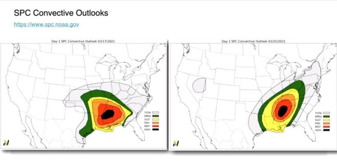
However, with that favorable weather forecast for the Wisconsin area also comes likelihood of an active severe weather season, Snodgrass said. Throughout the year, severe weather like tornadoes ramp up in frequency starting in May and June, keeping steady throughout the rest of the year. He said that current data shows Wisconsin having two high-risk days for severe weather so far this year, when the typical is usually one only every other year.

"(There) was a major outbreak of severe weather in parts of Mississippi and Alabama ... 61 separate tornadoes that hit that area," Snodgrass said. "I think we do need to be having this discussion this time of year about what our risk for severe weather is going to be, talking about the risk of drought or flooding, and everything in between."
Texas and New Mexico are also experiencing dust storms, a sign of how dry the soil is there, Snodgrass said. California is also experiencing its driest wet season in 40 years. Snodgrass added that these conditions lead to higher risk of wildfire spreading in those regions, as well as water for irrigation being severely limited. Wisconsin is sitting right at the average for precipitation.
Snodgrass was a guest on a recent episode of Professional Dairy Producers of Wisconsin's podcast "Dairy Signal."